Construction Drone Progress Reporting Richmond Va
Professional Drone Progress Updates for Builders Across Central Virginia
Stay informed at every phase of your project with New Altitude Photography & Aerial’s construction progress reporting services in Richmond, VA and surrounding areas. We provide professional drone construction progress documentation for builders, developers, project managers, and commercial contractors throughout Richmond, Mechanicsville, Hanover County, Chesterfield, Henrico, and Central Virginia.
Our FAA Part 107 certified drone pilots capture high-resolution aerial imagery, 2D orthomosaic site maps, and consistent visual updates that clearly document each stage of construction — from site prep and foundation work to framing and final build-out. These detailed aerial progress reports help verify completed work, track milestones, and maintain accurate records for stakeholders and investors.
Drone construction progress reporting reduces the need for frequent site visits while improving communication and overall project oversight. With scheduled aerial updates, you gain a complete visual timeline of your job site, making it easier to monitor efficiency, identify potential issues early, and keep projects on schedule.
✔ Improve project visibility and oversight
✔ Strengthen communication with clients and stakeholders
✔ Document milestones with precision and clarity
✔ Create a reliable visual record for every phase of construction
If you’re searching for construction drone services in Richmond, VA, trust New Altitude Photography & Aerial for dependable, professional progress reporting from above.
📸 Schedule your next construction progress flight in Richmond today and keep your project moving forward with confidence.
Precision Aerial Imaging & Construction Documentation Designed to Deliver Results
Progess Reporting
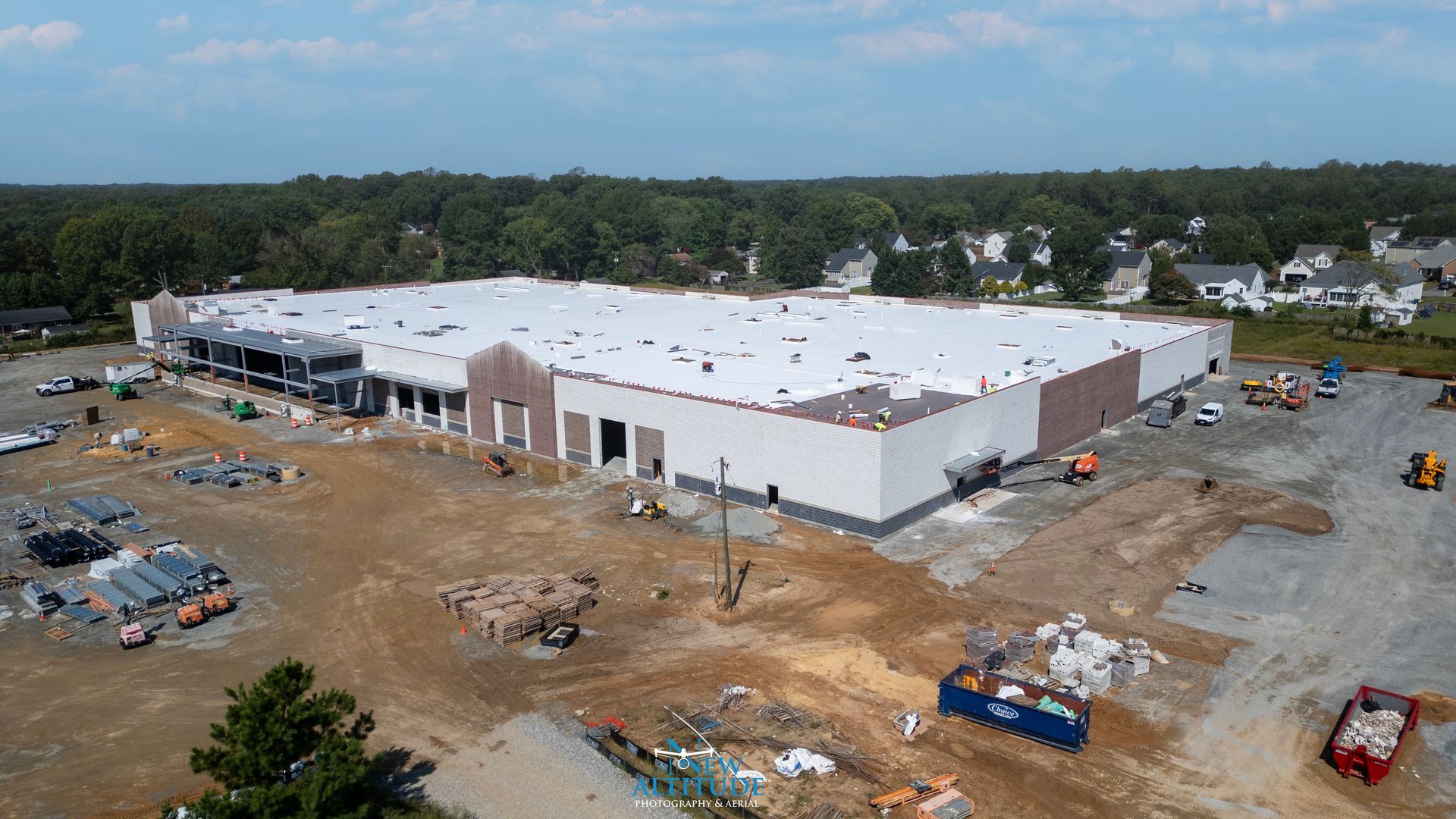
Construction Progress Reporting
At New Altitude Photography & Aerial, we provide professional construction drone progress reporting in Richmond, VA and throughout Central Virginia to keep your team informed and your project on schedule. Our FAA Part 107 certified pilots capture high-resolution aerial photography and video to document every stage of construction — from initial site preparation in Richmond and Mechanicsville to final completion. With accurate drone mapping, time-stamped aerial visuals, and detailed progress reports, you gain complete visibility into your job site, improve communication with stakeholders, and maintain accountability across every phase of your build.

Orthomosaic & 2D/3D Mapping
At New Altitude Photography & Aerial, we provide professional drone mapping services in Richmond, VA, specializing in high-accuracy orthomosaic maps and detailed 2D and 3D models that improve how construction teams plan, measure, and manage projects across Central Virginia. Using advanced drone technology and precise flight planning, we capture aerial data that is processed into scalable, geo-referenced maps ideal for site analysis, construction progress tracking, land development planning, and project documentation. Our Richmond drone mapping solutions deliver centimeter-level accuracy to support builders, engineers, and developers throughout Mechanicsville, Hanover County, Chesterfield, and surrounding areas.
Why Drones Are Important to Construction | New Altitude Photography & Aerial
Drone technology is transforming how the construction industry plans, monitors, and delivers projects. At New Altitude Photography & Aerial, we provide professional drone services that help builders, contractors, and project managers gain a complete view of every stage of construction — from groundbreaking to completion.
Our aerial photography and drone mapping solutions capture high-resolution images, 3D site models, and real-time progress updates, empowering teams to make faster, smarter decisions.
🔍 Key Benefits of Drone Technology in Construction
✅ Accurate Progress Tracking
Get up-to-date aerial visuals that document site development and help verify timelines and work completed.
✅ Improved Accuracy & Data Quality
Our drones deliver centimeter-level precision for mapping, measurements, and volumetric calculations, reducing costly errors.
✅ Enhanced Job Site Safety
Drones eliminate the need for workers to climb, enter, or navigate hazardous areas—keeping everyone safe.
✅ Better Communication & Transparency
Visual progress reports make it easy to share updates with stakeholders, investors, and clients.
✅ Time & Cost Efficiency
Faster data collection and site analysis save valuable time and reduce operational costs.
🚁 Why Choose New Altitude Photography & Aerial
Our FAA-certified drone pilots are experienced in construction progress reporting, site mapping, orthomosaic imaging, and inspection services across Richmond / Mechanicsville Virginia and surrounding regions. We partner with general contractors, developers, and engineering firms to deliver reliable, accurate, and visually compelling aerial documentation.
📸 Let’s Elevate Your Next Project
Experience the difference professional construction drone photography makes.
Contact Us Now
We’re here to answer questions, provide estimates, or talk about how our aerial services can support your team.